Geoscience

Glacial Fluting near Hodgson
Introduction:
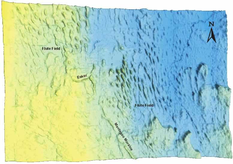
 Much of the interlake area of southern Manitoba comprises a fluted till plain. This ridge and swale topography provides an insight into which direction the glaciers flowed through the area, the riges (flutes) being parallel to ice flow. In these images the flute fields clearly indicate ice derived from the northwest. These glacial landforms are traditionally thought to be carved directly by glacial ice, however recent research suggests that they are carved by the turbulent water of sub-glacial sheet floods.
- Glacial Fluting Image #1 (see below)
- Glacial Fluting Image #2
- Glacial Fluting Image #3
Glacial Fluting near Hodgson Image #1
Undraped DEM, 1.0x VE, Orthogonal View
For a large view of this image.