Geoscience
Preliminary Exploration Database for Platinum Group Elements (PGE) in Manitoba
 PGE Report Home
 Introduction
 Release Information
 Viewing the Report
 PGE Index Map
 Analytical Data
 Data Sources
 Black Shales
 References
 Metal Prices
 Rock Samples
 Treatment of the Data
 Acknowledgments
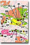
PGE Index Map #1
- The pge geological index map #1 shows the locations and reference identification number of all the occurrences contained in the main report database.
- To access the PGE Database you must download the of2000-5.pdf file.
- The reference identification number (two or three-digit number given for each location) is a unique value for each occurrence that is also given in the upper right-hand corner on the first page of each occurrence description (Ref ID.) in the text portion of the database.
- Use the occurrence hyperlinks that are set-up on the index map in of2000-5.pdf to move between this map and the main report database. The map is modified from the Bedrock Geology of Manitoba file contained in Viljoen et al. (1999).
- We have also provided two non-linked index maps which can also be downloaded from the ftp site. Reminder: the single index maps are not linked to the main database. Map #1 is the main pge occurence map and is the first page of the report in of2000-5.pdf and Map #2 is a topographic map which shows the red occurrence dots, as well as the names of lakes, towns, cities, railways and roads.
Sample
The thumbnail below leads to a close-up of an area in the north eastern part of Manitoba.

Go to the report release page for more information on the contents of the CD-ROM.
A ZIP file containing the contents of the CD-ROM is available to download free of charge.
Sample Location Maps (not linked to the database):
|
Geological Legend:
|


