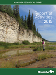
Geoscience
Report of Activities 2015
 Table of contents (135 KB)
 Opening pages (412 KB)
 Minister's Message (436 KB)
 Project Location Map (664 KB)
 Annual review by C.O. Böhm (3.9 MB)
 Manitoba Geological Survey and External Publications - December 2014 to November 2015 (217 KB)
Chapters by Areas:
 Superior Province
 Trans-Hudson Orogen
 Phanerozoic
 Quaternary
 Outreach
Note: all pdfs are 600 dpi to maximize image depth and printability. Best viewed and printed with Adobe Acrobat Reader. Available in alternate formats upon request.
Superior Province
GS-1 (6 MB)
Preliminary results of bedrock mapping at southern Knee Lake, northwestern Superior province,
Manitoba (parts of NTS 53L14, 15)
by S.D. Anderson, E.C. Syme, M.T. Corkery, A.H. Bailes and S. Lin
MGS Data Repository Item DRI2019007 is supplementary to this report. (Microsoft® Excel® file)
MGS Data Repository Item DRI2019008 is supplementary to this report. (Microsoft® Excel® file)
GS-2 (13 MB)
Preliminary results from bedrock mapping in the southern and central Cauchon Lake area, eastern
margin of the Pikwitonei granulite domain, central Manitoba (parts of NTS 63P7, 8)
by C.G. Couëslan and V.E. Guevara
Trans-Hudson Orogen
GS-3 (9 MB)
Examination of exploration drillcore from the Reed Lake area, Flin Flon belt, west-central Manitoba
(parts of NTS 63K9, 10): implications for the stratigraphy of the Fourmile Island assemblage and setting
of VMS deposits
by S. Gagné
GS-4 (9 MB)
Geological investigations of the Keewatin River area, Lynn Lake greenstone belt, northwestern
Manitoba (parts of NTS 64C14, 15)
by X.M. Yang and C.J. Beaumont-Smith
GS-5 (7 MB)
Granitoid rocks in the Lynn Lake region, northwestern Manitoba: preliminary results of reconnaissance
mapping and sampling
by X.M. Yang and C.J. Beaumont-Smith
GS-6 (9 MB)
Geological mapping in the northern basin of Southern Indian Lake, north-central Manitoba (parts of
NTS 64G7, 8, 9, 10)
by T. Martins
Phanerozoic
GS-7 (4 MB)
Lineament mapping of the Hudson Bay Lowland using remote-sensing methods, northeastern Manitoba
(parts of NTS 53N, O, 54)
by M.P.B. Nicolas and B.W. Clayton
GS-8 (1 MB)
Potash deposits in the Devonian Prairie Evaporite, southwestern Manitoba (parts of NTS 62F, K)
by M.P.B. Nicolas
GS-9 (4 MB)
Preliminary results from geological investigations into gypsum, Harcus area, southwestern Manitoba
(NTS 62J10)
by K. Lapenskie and J.D. Bamburak
Quaternary
GS-10 (7 MB)
Quaternary geology of the Arden NTS area (62J6), southwestern Manitoba
by T.J. Hodder and M.S. Trommelen
MGS Data Repository Item DRI2016003 is supplementary to this report. (Microsoft® Excel® file)
NOTE: DRI2016003 was rereleased with corrected KIM classification (March, 2017).
GS-11 (6 MB)
Ice-flow mapping and till sampling in the northern area of Southern Indian Lake, north-central Manitoba
(parts of NTS 64G7–10)
by T.J. Hodder
GS-12 (5 MB)
Preliminary Quaternary geology in the Gillam area, northeastern Manitoba – year 3 (parts of NTS
54D5–9, 11, 54C12)
by S.E. Kelley, T.J. Hodder, Y. Wang, M.S. Trommelen and M. Ross
Outreach
GS-13 (925 KB)
Roadside geology of southern Manitoba
by J.D. Bamburak and J.M. Pacey
Contact:
Publication Sales
360 - 1395 Ellice Avenue
Winnipeg MB Canada R3G 3P2
Telephone: 204-945-1119
Toll-free: 1-800-223-5215
Fax: 204-945-8427
E-mail: minesinfo@gov.mb.ca


