Field Trips
To further the geological education of staff from the
participating agencies of the TGI II project, two fieldtrips were
made during 2004 to visit field sites, located mainly in Manitoba’s
outcrop belt. As most of the TGI project concerned subsurface maps,
it was important that the researchers have an opportunity to view
stratigraphic units as they appear in outcrop. Two field guidebooks,
shown below, were prepared and are downloadable. Some pictures of
the fieldtrips are also presented.
To go on a virtual field trip, click here.
Please contact the respective land owners before venturing onto
private and Crown lands.
Materials are available in alternate formats upon request.
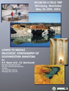
Lower to Middle
Paleozoic Stratigraphy of Southwestern Manitoba
WCSB/TGI II FIELD TRIP
Winnipeg, Manitoba
By R. K. Bezys and J. D. Bamburak
Manitoba Geological Survey
Industry, Trade and Mines
360-1395 Ellice Ave.
Winnipeg, MB, R3G 3P2Click thumbnails below to enlarge
|
|

Click cover to download
(PDF, 15 MB) |

Stop 1 Gillis Quarry – May 25, 2004
Field trip participants on the lower bench of Ordovician Selkirk
Member of the Red River Formation (Tyndall Stone) in Gillis
Quarry, located 1 km east of Garson in southeastern Manitoba.
From left to right: Ruth Bezys, Andre Kosta,
Greg Keller, Michelle Nicolas, Patti Thomas (partly blocked),
Donna Gillis (of Gillis Quarries Limited), Gaywood Matile
(blocked), Dan Barchyn, Kim Kreis, John Fox, Carol Martiniuk
(partly blocked), Gavin Jensen, Ben Rostron, Dan Palombi, Derek
Bogdan
|
|

Stop 13a Gunnlaugson Farm Reef – May 26, 2004
Field trip participants posing on top of vegetation-covered
Devonian Winnipegosis Formation reef mound, on Gunnlaugson Farm
on Richards Point, a few kilometres north of the Lake Manitoba
Narrows.
First Row – from left to right: Derek Bogdan,
Andre Kosta, Patti Thomas, Haitham Hamid
Standing – from left to right: Ben Rostron, Ruth Bezys, Dan
Barchyn, Kim Kreis, Igor Morozov, Gavin Jensen, Dan Palombi, Don
Kent, Dan Khan, Jim Bamburak
|

Stop 15 Winnipegosis Quarry – May 26, 2004
Field trip participants standing on Devonian Sagamace Member of
Souris River Formation in Winnipegosis Quarry, a few kilometres
west of Winnipegosis, Manitoba.
From left to right: Patti Thomas, Ruth Bezys, Haitham Hamid, Don
Kent, Igor Morozov (blocked), Dan Palombi, Gavin Jansen (facing
away), Ben Rostron
|
|

Stop 22 The Bluff Reef – May 27, 2004
Field trip participants examining outcrop of Devonian Winnipeg
Formation reef mound with stromatoliths, on The Bluff on the
west shore of Dawson Bay in the north basin of Lake Winnipegosis.
From left to right: Don Kent, Dan Khan, Kim Kreis, Gavin Jensen,
Ben Rostron (facing away) |
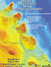
Mesozoic Stratigraphy of the Manitoba Escarpment
WCSB/TGI II Field Trip
Saskatchewan/Manitoba
September 7-10th, 2004
By J.D. Bamburak1 and J.E. Christopher (Retired)2
1 Manitoba
Geological Survey
Manitoba Industry, Economic Development and Mines
360-1395 Ellice Avenue
Winnipeg, MB., R3G 3P2
2 Saskatchewan
Geological Survey
Saskatchewan Industry and Resources
201 Dewdney Avenue
Regina, SK., S4N 4G3
Click thumbnails below to enlarge
|
|

Click cover to download
(PDF, 10.4 MB) |

Stop 10 East Favel River Outcrop – September 8, 2004
Field trip participants posing in front of stream cut exposure
of Cretaceous Morden Shale overlying Marco Calcarenite within
Assiniboine Member of the Favel Formation, in valley of East
Favel River, 6.1 km south of Minitonas, Manitoba.
From left to right: Jim Christopher, Jim Bamburak, Dave McNeil,
Heather Groom (facing away) |
|

Stop 10 East Favel River Outcrop – September 8, 2004
Field trip participants examining stream cut exposure of
glacial till overlying Cretaceous Morden Shale above oxidized
Marco Calcarenite within Assiniboine Member of the Favel
Formation, in valley of East Favel River, 6.1 km south of
Minitonas, Manitoba.
From left to right (facing away): Andre Costa, Per Pedersen,
Gaywood Matile, Stacey Spooner, Michelle Nicolas
|

Stop 10 East Favel River Outcrop – September 8, 2004
Field trip participants discussing stratigraphy in front of
stream cut exposure of Cretaceous Morden Shale overlying Favel
Formation, in valley of East Favel River, 6.1 km south of
Minitonas, Manitoba.
From left to right: Gaywood Matile, Dave McNeil, Heather Groom
(facing away), Jim Christopher, Kim Kreis, Jim Bamburak (facing
away) |
|

Stop 15 Vermilion River Downstream Outcrop – September 8, 2004
Field trip participants discussing stream cut exposure of
Cretaceous Keld Member of the Favel Formation overlying the
Belle Fourche Member of the Ashville Formation on the east bank
of the Vermilion River, about 10.5 km southwest of Dauphin,
Manitoba
From left to right (facing away): Melinda Yurkowski, Dave
McNeil, Per Pederson |

|