Williston Basin TGI header


Williston Basin TGI project logo
 

Downloads

TGI Stratigraphic Map Series Data Files

Data files used to create the stratigraphic maps series are supplied for each horizon. The data file can be downloaded here, and contains the raster file in ArcInfo grid format, data point shapefiles, contour shapefiles (structure and/or isopach), and the formation edge shapefiles.

The specialized combinations of spatial interpolation and filtering were chosen to portray the regional trends of the data at a small scale. As such, some of the data points may not match the contour values accurately in places, and it would be difficult to replicate the maps using the TGI database without the actual modelling script that was developed specifically for this project. Use of the data files supplied for each horizon is at the user discretion.

Materials may be available in alternate formats upon request.


Geophysical Investigations

This final geophysical report consists of regional gravity and high-resolution aeromagnetic maps that were compiled for the Williston Basin within the TGI study area, resulting in a seamless tectonic framework of the Precambrian basement rocks buried beneath the Phanerozoic sediments.


Contents:

TGI Stratigraphic Map Series Data Files

Geophysical Investigations

Project Reports

Cross-Sections

Stratigraphic Column

Field Trip Guidebooks

Other Published Reports
 

J.Li and Morozov, I., 2007: Geophysical Investigations of the Precambrian Basement of the Williston Basin in south-eastern Saskatchewan and south-western Manitoba.

Download/view the Report file (PDF)

The images are provided in separate files that can be obtained by following the links below.

Map list

The links provide below give the corresponding maps in PDF format suitable for viewing and printing page-size as well as in about 1m by 1m images. The image file names begin with the map numbers followed by self-descriptive abbreviated captions. Note that several images have multiple versions (typically, contoured or non-contoured maps), indicated by letters appended to the figure numbers.

TGI Location Overlay Map - This PDF map can be overlain on each of the report's PDF maps in order to provide additional locational assistance.


1)     Surface topography of TGI2 area;

2)     Locations of gravity stations;

3)     Bouguer gravity anomaly;

4)     Contoured Bouguer gravity anomaly;

5)     Aeromagnetic total residual intensity anomaly;

6)     Horizontal derivative of Bouguer gravity;

7)     Vertical first derivative of Bouguer anomaly;

8)     Second vertical derivative of Bouguer gravity;

9)     Analytic Signal of Bouguer gravity;

10)   Tilt derivative (TDR) of Bouguer gravity;

11)   Isostatic residual gravity anomaly;

12)   Magnetic anomaly reduced to the pole;

13)   Horizontal first derivative of magnetic anomaly;

14)   First vertical derivative of magnetic anomaly;

15)   Second vertical derivative of magnetic anomaly;

16)   Analytic Signal of magnetic anomaly;

17)   Tilt derivative (TDR) of magnetic anomaly;

18)   Band-pass filtered magnetic anomaly;

19)   Magnetic source pseudo gravity;

20)   Magnetic basement structural pattern;

21)   Precambrian model from interpolated well picks and seismic results;

22)   Precambrian topography inverted by Euler deconvolution method;

23)   Interpreted structural units and domains on magnetic field background;

24)   Interpreted structural units and domains;

25)   Interpreted lineament structure;

26)   Interpreted NW regional faults.


Project Reports

GP2008-1.pdf
Nicolas, M.P.B. 2008: Williston Basin Project (Targeted Geoscience Initiative II): results of the biostratigraphic sampling program, southwestern Manitoba (NTS 62F, 62G4, 62K3); Manitoba Science, Technology, Energy and Mines, Manitoba Geological Survey, Geoscientific Paper GP2008-1, 28 p.

GP2008-2.pdf
Nicolas, M.P.B., and Barchyn, D. 2008: Williston Basin Project (Targeted Geoscience Initiative II): summary report on Paleozoic stratigraphy, mapping and hydrocarbon assessment, southwestern Manitoba; Manitoba Science, Technology, Energy and Mines, Manitoba Geological Survey, Geoscientific Paper GP2008-2, 21 p.

GP2009-1.zip
Nicolas, M.P.B. 2009: Williston Basin Project (Targeted Geoscience Initiative II): Summary report on Mesozoic stratigraphy, mapping and hydrocarbon assessment, southwestern Manitoba; Manitoba Science, Technology, Energy and Mines, Manitoba Geological Survey, Geoscientific Paper GP2009-1, 19 p.


Cross Sections - Manitoba

Here are downloadable cross-sections through the Manitoba portion of the TGI project area showing the Lower Paleozoic (Silurian to Precambrian) sequences. 

Cross-section of Lower Paleozoic sequence going north-south near the Manitoba-Saskatchewan border, includes well logs and cross-section location map.
PDF - 3.3 MB

Cross-section of Lower Paleozoic sequence going east-west along approximately Townships 12 to 14 from the Manitoba-Saskatchewan border to the Manitoba outcrop belt, includes well logs and cross-section location map.
PDF - 3.2 MB

Cross-section of the entire Mesozoic and Paleozoic sequence, going east-west from Township 15-25W2 (SK) to Township 13-6E (MB) into Manitoba's outcrop belt.
PDF - 407 KB


Stratigraphic Column

TGI Strat Movie

Animated movie of the major stragraphic units mapped for the TGI project, onlapping in sequence from Precambrian basement to the Upper Cretaceous Belly River Formation.

AVI - 3.8 MB


Stratigraphic Equivalencies Table

TGI stratigraphic equivalencies used in this project, showing correlations of eastern Saskatchewan to the Manitoba subsurface and outcrop stratigraphy.

PDF - 55 KB (Updated January, 2009)


TGI II Poster presentation displayed at the 13th Annual Williston Basin Petroleum Conference – Regina 2005

Panel 1 - PDF, 5 MB

Panel 2 - PDF, 18 MB


Field Trip Guidebooks

Two field guidebooks, shown below, were prepared for the project and are downloadable.

Please contact the respective land owners before venturing onto private and Crown lands.

For more on the field trips and to go on a virtual field trip, please visit the Field Trips page.

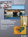
Lower to Middle Paleozoic Stratigraphy of Southwestern Manitoba

WCSB/TGI II FIELD TRIP
Winnipeg, Manitoba

By R. K. Bezys and J. D. Bamburak

Manitoba Geological Survey
Industry, Trade and Mines
360-1395 Ellice Ave.
Winnipeg, MB, R3G 3P2


Click image to download

Click cover to download
(PDF, 15 MB)


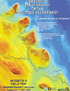
Mesozoic Stratigraphy of the Manitoba Escarpment

WCSB/TGI II Field Trip
Saskatchewan/Manitoba
September 7-10th, 2004

By J.D. Bamburak1 and J.E. Christopher (Retired)2

1 Manitoba Geological Survey
Manitoba Industry, Economic Development and Mines
360-1395 Ellice Avenue
Winnipeg, MB., R3G 3P2

2 Saskatchewan Geological Survey
Saskatchewan Industry and Resources
201 Dewdney Avenue
Regina, SK., S4N 4G3


Click image to download

Click cover to download
(PDF, 10.4 MB)


Field Trip Gas Well Demonstration

The gas well, shown in the videos, is situated on the north flank of the Pembina Hills, 6 km north-northeast of Notre Dame de Lourdes, MB, on the farm of Norman and Guy Bosc. In the 1930s, the well was drilled to a depth of about 52 m into the Cretaceous Favel Formation (Second White Specks), which is known to contain oil shale. The well produces natural gas, with a weak petroleum smell, that burns when ignited. The gas pressure drops to 3 lbs after being opened for ½ hour. When the valve is closed, the well recharges with 32 lbs gas pressure every 12 hours. Poor quality drinking water has been encountered in all nearby water wells.

Quicktime mov file (7.4 MB)

MPG file (15.4 MB)


Other Published Reports

Christopher, J.E., Yurkowski, M., Nicolas, M., and Bamburak, J. (2006): The Upper Cretaceous (Turonian-Santonian) Carlile Formation of eastern southern Saskatchewan, and the correlative Morden and Boyne members of southwestern Manitoba; in Summary of Investigations 2006, Volume 1, Saskatchewan Geological Survey, Sask. Industry Resources, Misc. Rep. 2006-4.1, CD-ROM, Paper A-13, 16p.

Christopher, J.E. and Yurkowski, M. (2005): The Upper Cretaceous (Turonian) Second White Specks Formation of eastern Saskatchewan; in Summary of Investigations 2005, Volume 1, Saskatchewan Geological Survey, Sask. Industry Resources,Misc. Rep. 2005-4.1, CD-ROM, Paper A-18, 12p

Back to top