
Historic Flood - 1950
The 1950 flood was the largest flood in the Red River Valley since 1861. Major flooding took place in Winnipeg and the Red River Valley in April, May and June. The melting of heavy snow caused the Red River to reach flood levels in Winnipeg by April 22. A heavy rainfall in early May caused the river to peak at a 9.2 metres (30.2 feet) at James Avenue in Winnipeg. The levels stayed above the flood stage for 51 days. The water depth reached 4.6 metres (15 feet) in low lying areas. Heavy snow during the previous winter and heavy spring rain contributed to flood conditions.
|
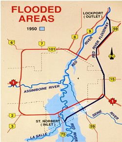
Flood areas in 1950 |
A state of emergency was declared and the Canadian Army and Red Cross were brought in to help protect residents and property and help with evacuations. Over the course of the flood, 100,000 residents (one third of Winnipeg) were evacuated from their homes - the largest evacuation in Canadian history (until the 1979 Mississauga train derailment). Approximately 10,000 homes were destroyed and 5,000 buildings were damaged. It was estimated that the 1950 flood resulted in $125.5 million in damages (about $1 billion in today's figures.)
 |
 |
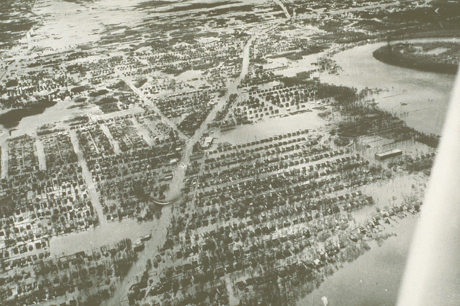
An aerial photo showing flooding in the St. Vital area, 1950 |
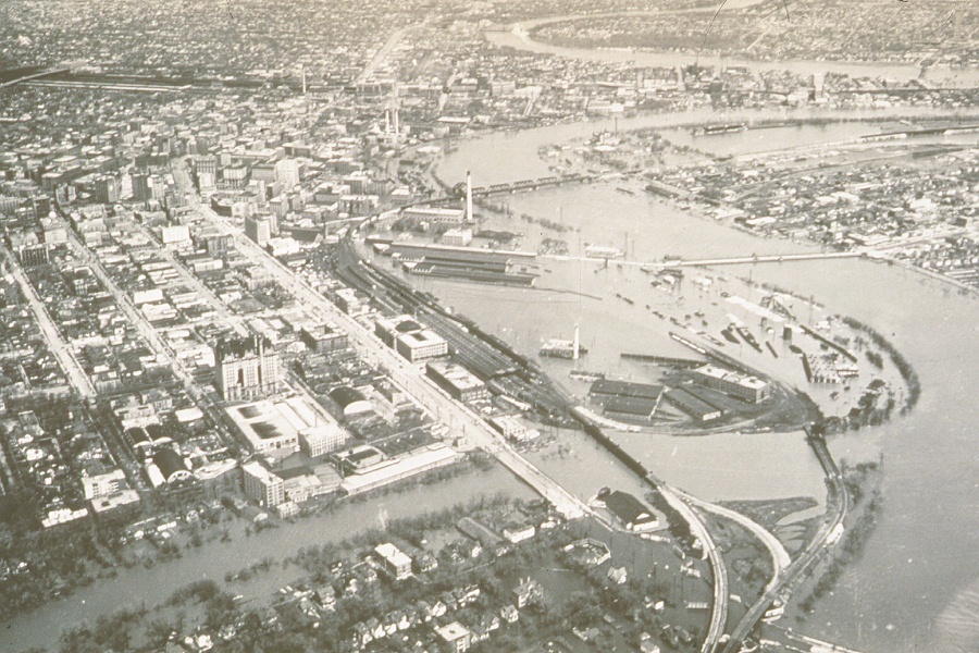
An aerial photo showing flooding in the former CNR rail yards at The Forks in downtown Winnipeg, 1950 |
 |
 |
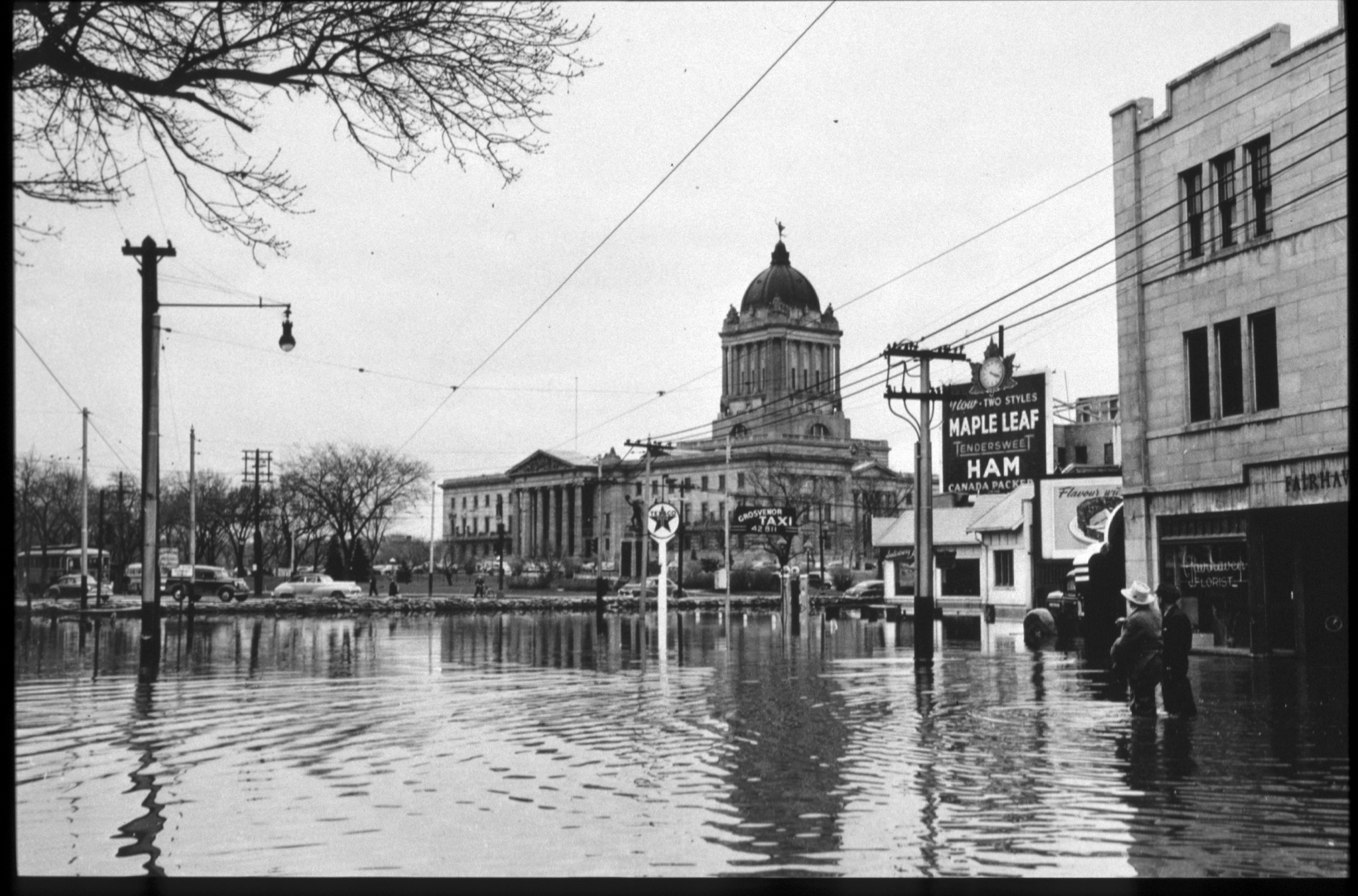
View of the Manitoba Legislative Building seen from the flooded Broadway Avenue in Winnipeg, 1950 |
View of Assiniboine Avenue flooded in 1950 |
 |
 |
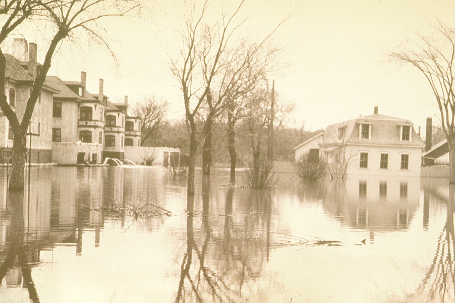
View of Elm Park in Fort Garry flooded in 1950 |
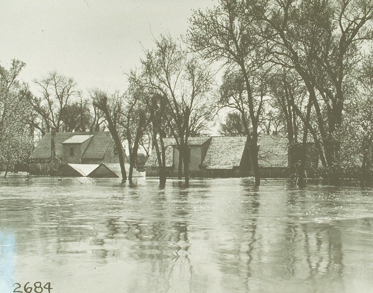
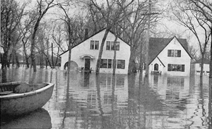
View of flooded homes in the Fort Rouge area, 1950 |
 |
 |
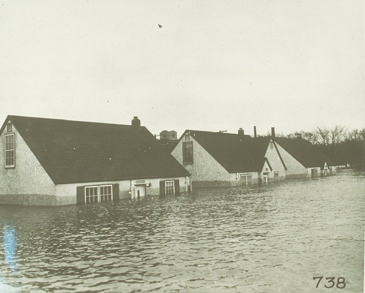
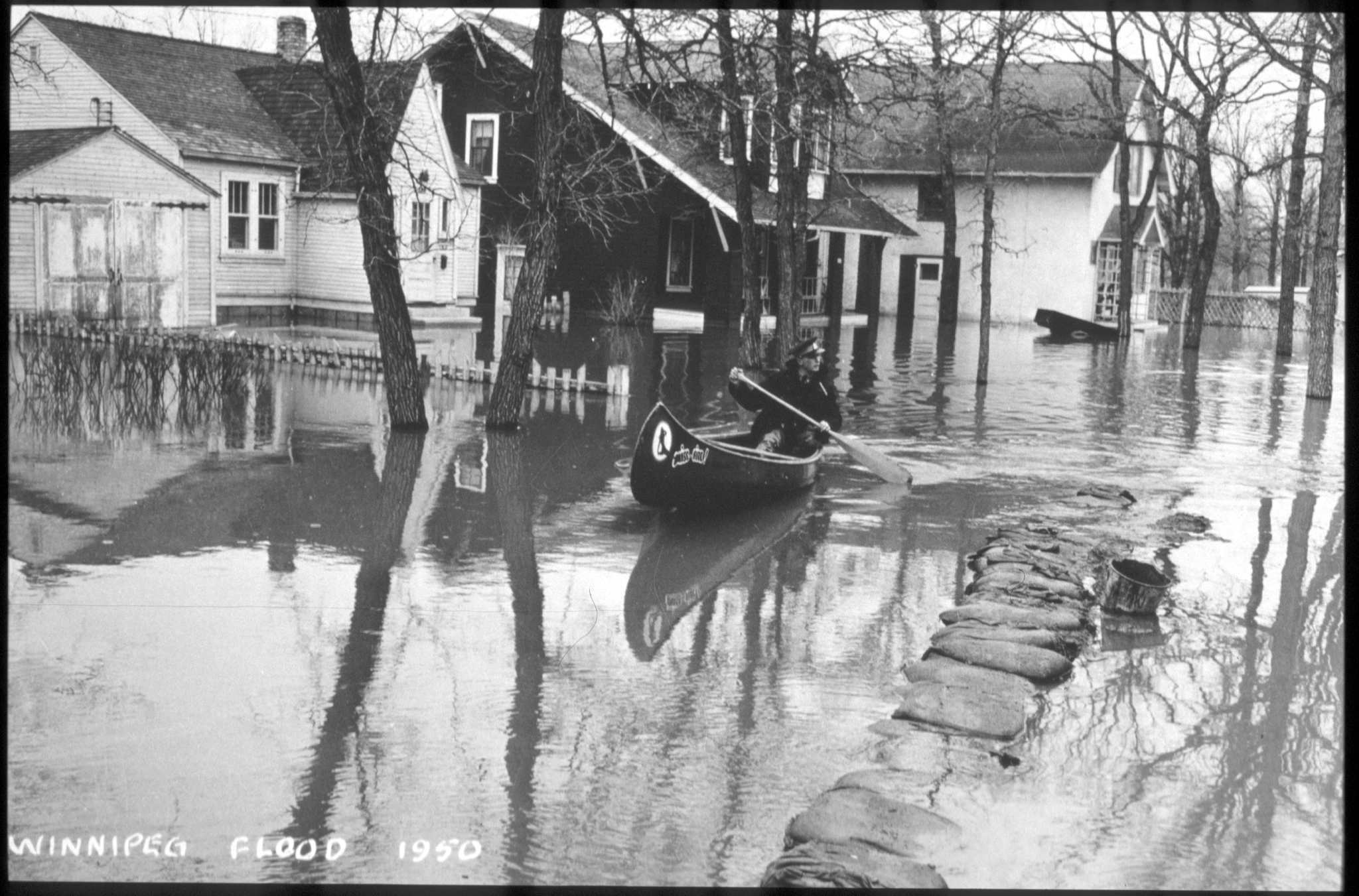
| Image of man canoeing in a flooded residential area, 1950 | Flooded homes on Scotia Street, 1950 |
 |
 |
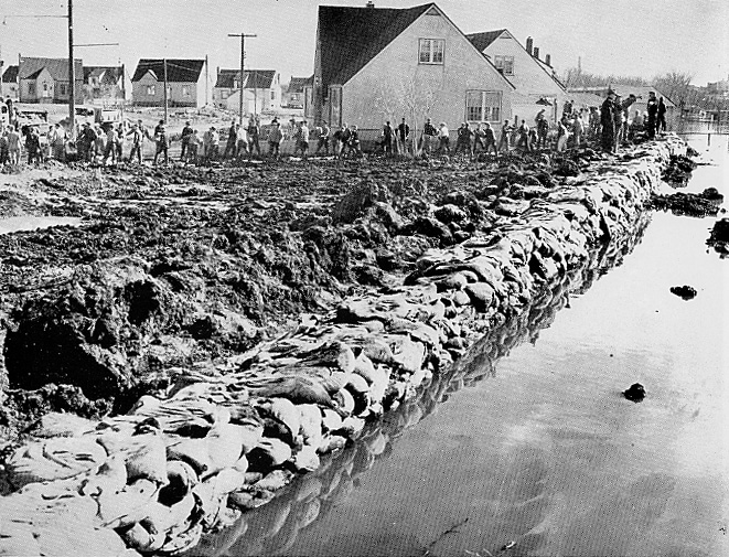
Volunteers sandbagging Winnipeg streets, 1950 |
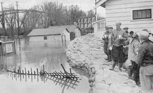
Water being held back by the Glenwood Crescent Dike, 1950 |
 |
 |
News anchor standing in knee deep water behind a sandbag dike while covering a story, 1950 |
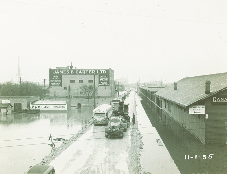
Trucks driving on a raised road through a flooded commercial area, 1950 |
 |
 |
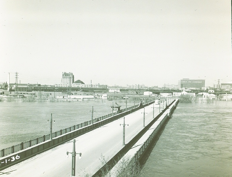
Flood waters almost reaching the height of the old Provencher Bridge, 1950 |
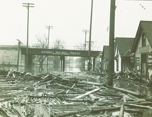
Debris scattered under a flooded CNR Line, 1950 |
Reports
Please visit the reports page for all Red River Flood Reports
Links
- http://www.collectionscanada.gc.ca/sos/002028-1200-e.html?PHPSESSID=gj191qoh91idmvrkkv03trjco2
- http://www.cbc.ca/archives/entry/a-city-submerged-winnipeg-and-the-flood-of-1950
- http://www.canadashistory.ca/Magazine/Trading-Post/Trading-Post-List/Articles/Record-Manitoba-Flood-of-1950