![]() Geoscience
Geoscience
Geological Survey Activity TrackerFlin Flon Belt and Kisseynew
Geology and mineral potential of the Brunne Lake areaProject Status: Completed (2019)
|
 Project Information
Principal investigators:
Simon Gagné
Partnered with:
--
Location:
Parts of NTS 63K11/ 63K14
Project Description
Main objectives:
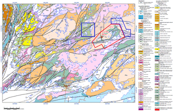
This project aims to produce a new geological map with marginal notes for the Brunne Lake area which was entirely burn during a 2010 forest fire. The newly revealed exposures will allow to significantly update the geological map for the area which was last mapped by the GSC in the early 1950`s. This project will provide a better understanding of the stratigraphy, tectonic evolution and geological setting of gold mineralization of the Brunne Lake area.
Methodology:
The project will include systematic 1:10 000 scale geological mapping of volcanic and volcaniclastic rocks. The various granitic intrusions will be mapped at a 1:20 000 scale. In addition, detailed lithological and structural mapping will focus on known gold mineralization occurrences. To complement geological fieldwork, focused lithogeochemistry and Sm-Nd isotopic analyses will be obtained from the various rock units. Drill core from selected drill holes intersecting mineralized zones will be examined in details in order to better understand the geological setting of gold mineralization.
Benefits:
The new 1:10 000 scale geological map will significantly improve our knowledge of the stratigraphy, unit distribution and structural geology of this poorly understood package of volcanic rocks. The results from geological mapping will be complemented by geochemical analysis and isotopic data in order to establish the geochemical affinity of the volcanic assemblage and its tectonic setting. The project also aims to provide a better understanding of the nature and controls of gold mineralization found within the Brunne Lake area and to provide exploration companies with new exploration guidelines.
Completed outputs:
2014-2015
Dunn, J.A. 2014: Geological setting of gold mineralisation in the Gurney Mine shear zone, Brunne Lake, Manitoba; University College Cork, Republic of Ireland, M.Sc. thesis, 110 p.
Dunn, J.A. and Gagné, S. 2014: Characteristics and controls of gold mineralization in the Brunne Lake area of the Flin Flon belt, west-central Manitoba (parts of NTS 63K11, 14); in Report of Activities 2014, Manitoba Mineral Resources, Manitoba Geological Survey, p. 116–124.
2012-2013
Gagné, S., 2012: Geological investigations in the Brunne Lake area of the Flin Flon Belt, west-central Manitoba (parts of NTS 63K11, 14); in Report of Activities 2012, Manitoba Innovation, Energy and Mines, Manitoba Geological Survey, p. 90–103.
Gagné, S. 2012: Geology of the Brunne Lake area, Flin Flon Belt, west-central Manitoba (parts of NTS 63K11, 14); Manitoba Innovation, Energy and Mines, Manitoba Geological Survey, Preliminary Map PMAP2012-6, scale 1:10 000.
Gagné, S. 2012: New geological mapping and setting of gold mineralization in the Brunne Lake area, Flin Flon belt (parts of NTS 63K11 and 63K14); Manitoba Innovation, Energy and Mines, Manitoba Geological Survey, Manitoba Mining and Minerals Convention 2012, Winnipeg, Manitoba, November 15-17., 2012, poster presentation.
Gagné, S. 2012: New Data from Bedrock Geological Mapping in the Brunne Lake-Gurney Mine Area and Implications for Gold Mineralization [abstract]; Manitoba Innovation, Energy and Mines, Manitoba Mining and Minerals Convention 2012, Winnipeg, Manitoba, November 15-17, 2012, Program, p. 55.


