GIS Map Gallery Geographic Information System
|
 |
Rp/Rc/Rm – rock
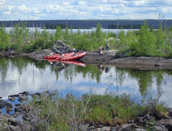
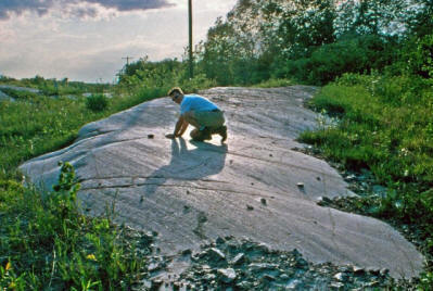
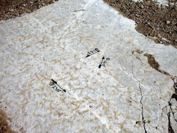
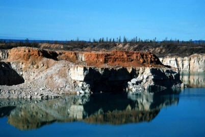
Rock outcrops are common in the central and eastern portions of the province and diminish to the southwest and north, where sediment cover is generally thicker. Image 37 is typical of the Precambrian rock outcrops in the Canadian Shield. Image 38 shows a glacially striated (scratched parallel to ice flow) Precambrian rock outcrop near Lac du Bonnet. The striations are being measured for mineral exploration purposes. Ice flow was from right to left, as is evident from the steeper (plucked) rock face to the left. Image 39 depicts a striated Ordovician rock outcrop near Hecla Island with multiple ice flow directions preserved. Many of Manitoba’s mineral resources are found in bedrock and, when close to the surface, can be quarried for minerals or crushed for aggregate (Image 40).
 Image 37
|
 Image 38 |
 Image 39 |
 Image 40 |
 Back to Surficial Geology Compilation Map Series of Manitoba (SGCMS)


