GIS Map Gallery Geographic Information System
|
 |
O – Organic peat, muck
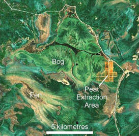
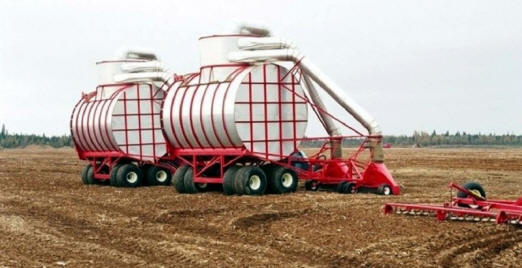
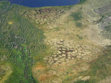
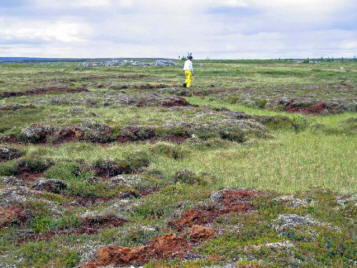
Wetlands can be subdivided into four categories: fens, bogs, swamps and marshes. Fens and bogs are areas of peat accumulation that can be many metres thick, whereas the peat in swamps and marshes is constantly breaking down and therefore does not accumulate to a significant thickness. A bog tends to have a radial drainage pattern as it is higher than the surrounding fen, whereas a fen has a more uniform flow pattern, with rainwater and groundwater flowing through it (Image 1, source Google Earth, June 2007). Bogs contain a high percentage of sphagnum moss, which is valued for its absorbent properties (Image 2). In areas of permafrost, polygonal frost patterns are commonly found in wetlands (Images 3 and 4). Swamps and marshes are generally found west of Lake Manitoba and the Red River. Due to the insufficient thickness of peat in swamps and marshes, they are generally not represented on this map. Netley and Delta marshes (Image 8) are important exceptions.
 Image 1
|
 Image 2 |
 Image 3 |
 Image 4 |
 Back to Surficial Geology Compilation Map Series of Manitoba (SGCMS)


