GIS Map Gallery Geographic Information System
|
 |
Tp/Tc/Tm – glacial till
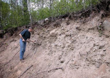
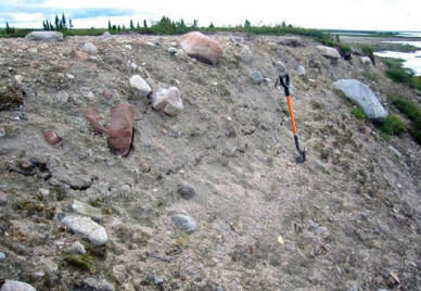
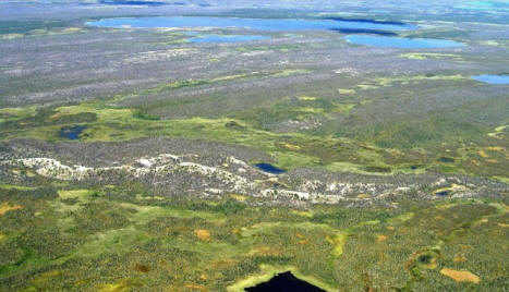
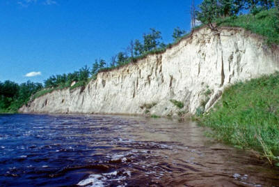
Because all of Manitoba was glaciated during the last glacial period, all rock outcrops were scraped and plucked by glacial ice and the resultant variably sized rock fragments transported, crushed and mixed into a sediment known as glacial till (Image 33). Pre-existing sediment can also be incorporated into the till. Till tends to have characteristics derived from the regional bedrock (e.g., locally derived rock fragments) and, as a result, is often sampled for mineral exploration purposes. Numerous landforms (e.g., flutes, drumlins and end moraines) can be composed of glacial till. Image 34 depicts a drumlin cut by a modern river, whereas Image 35 shows drumlins, aligned parallel to the direction of ice flow (top portion of image), that have been truncated by an esker (across the centre of the image). Rivers can cut large sections into the subsurface, in places exposing many layers of sediment/till (Image 36), thus giving geologists insight into the past.
 Image 33
|
 Image 34 |
 Image 35 |
 Image 36 |
 Back to Surficial Geology Compilation Map Series of Manitoba (SGCMS)


