GIS Map Gallery Geographic Information System
|
 |
A – alluvial sediments
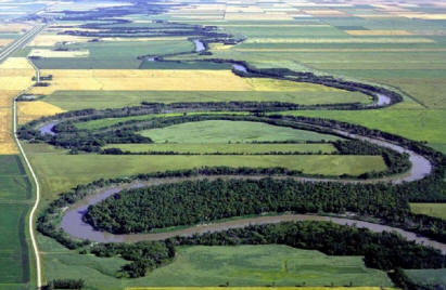
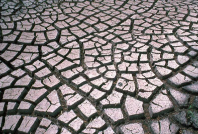
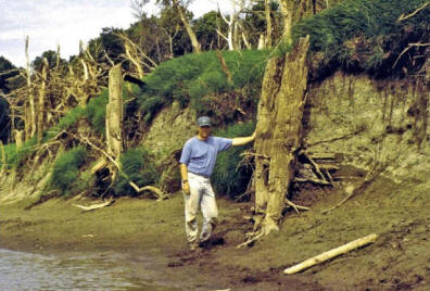
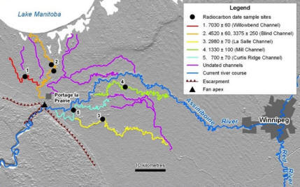
Alluvium is sediment eroded, carried and deposited by river water. Over time, through erosion and deposition, rivers become less straight and more meandering (Image 17). Rivers regularly deposit sediment on the floodplain (Image 18). Some trees have adapted to this environment growing a new set of roots whenever the sediment gets too deep (Image 19). The largest deposits of alluvium in Manitoba are alluvial fans which are deposited below abrupt changes in river slope. Image 20 depicts the evolution of the Portage la Prairie alluvial fan and indicates that the Assiniboine River initially drained into Lake Manitoba before it established its current course into the Red River (source: Rannie, W.F., Thorleifson, L.H. and Teller, J.T. 1989: Holocene evolution of the Assiniboine River paleochannels and Portage la Prairie alluvial fan; in Late Quaternary Paleohydrology of Canada, ed(s). Church, M., Clague, J.J. and Ritchie, J.C.; Canadian Journal of Earth Sciences, v. 26, no. 9, p. 1834-1841.).
 Image 17
|
 Image 18 |
 Image 19
|
 Image 20 |
 Back to Surficial Geology Compilation Map Series of Manitoba (SGCMS)


